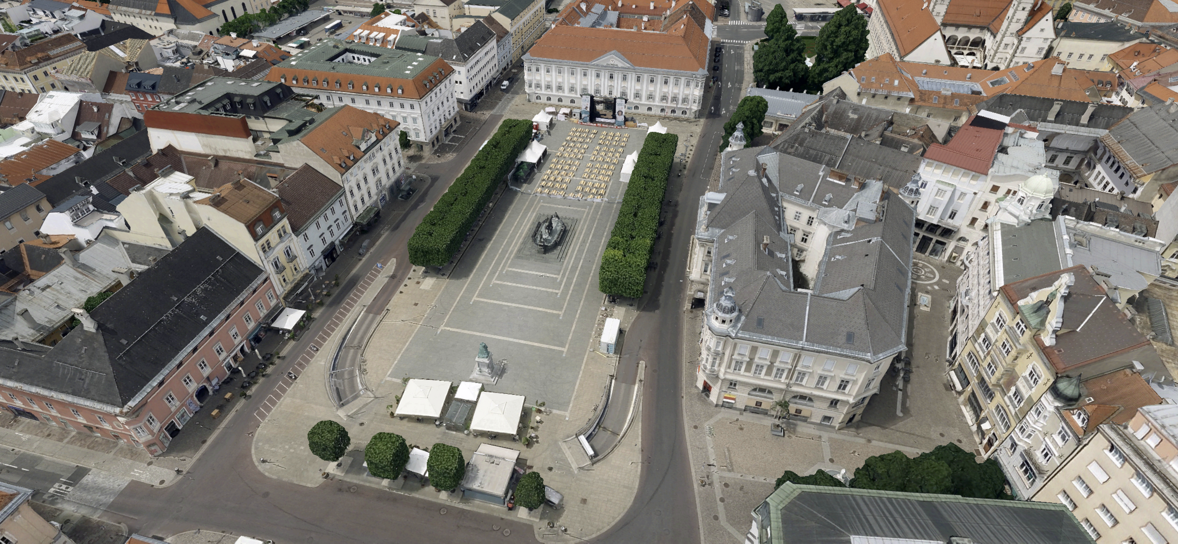
This became reality in the course of our prestige project “Digital Twin Klagenfurt” which illustrates the city of Klagenfurt in 3D. Aside from the visual enjoyment of an in-house AI calculated 3D model, integrated 3D/2D data can be used for environmental simulations, such as totaling solar energy potentials by the use of solar panels on roofs, or estimating temperatures of concrete due to solar radiation during a summer day. But the number of options is manifold.
Learn more about the advantages of M.App Enterprise
- Visualize geographical data in an App
- Integrate terrain data, 3D structures, meshes, 360° panoramic imagery and point clouds,...
- Easy-to-handle, customizable, extendible
- Access limitation settings... and more
With the Digital Twin Klagenfurt a Web Application was generated that combines 3D/2D datasets and extensive functionalities. Large 3D structures and meshes are streamed with high performance to be explored. Additional data sets support decision makers and organizations to get a comprehensive understanding of complex geospatial data interaction. In addition, various functions enable even more information gain, such as the querying of attributes or the measurement of distances. Besides that, Digital Twin Klagenfurt is accessible for the public, offering non-professionals a full 3D geoinformation system, which is easily accessed and handled.
What’s unique about this project?
Digital Twin Klagenfurt comprises a high-resolution 3D city model and additional Landcover images which were calculated with our in-house AI. So basically, the core piece of the data was all acquired, pre-processed and streamed within the responsibility of Hexagon sensors and software.
Data acquisition and Hexagon AI processing
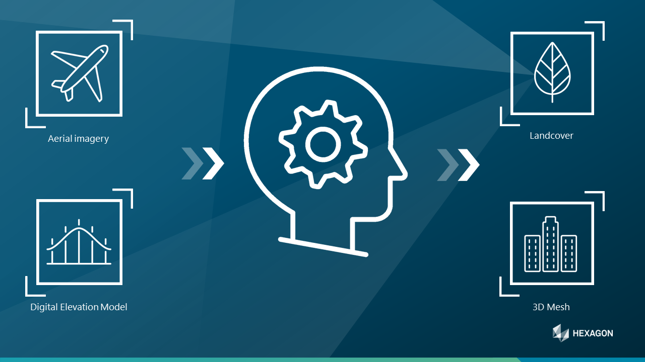
In the scope of Digital Twin Klagenfurt, raw sensor data (LIDAR) from overflights over the city of Klagenfurt was fed into our AI besides a digital elevation model. High-resolution obj files were generated, which represent 3D geometry of the entire city. Moreover, Landcover information was derived from the raw sensor data in the course of the AI calculations. Altogether, three main in-house data products can be distinguished:
1) 3D geometry in the form of obj files, which still need further processing to be used in our App and serve as photo-realistic 3D model (How to use Meshfactory - Converting obj files into OGC 3DTiles)
2) Landcover layers from both Ortho and Ground perspective are incorporated in the Web Application
3) True Orthophotos, which are a corrected form of conventional Orthophotos
Which additional datasets were used?
Besides our in-house AI generated data, several datasets were delivered from external sources, which are listed below. Nonetheless, some data pre-processing and preparation was still needed to incorporate the datasets in the WebApplication.
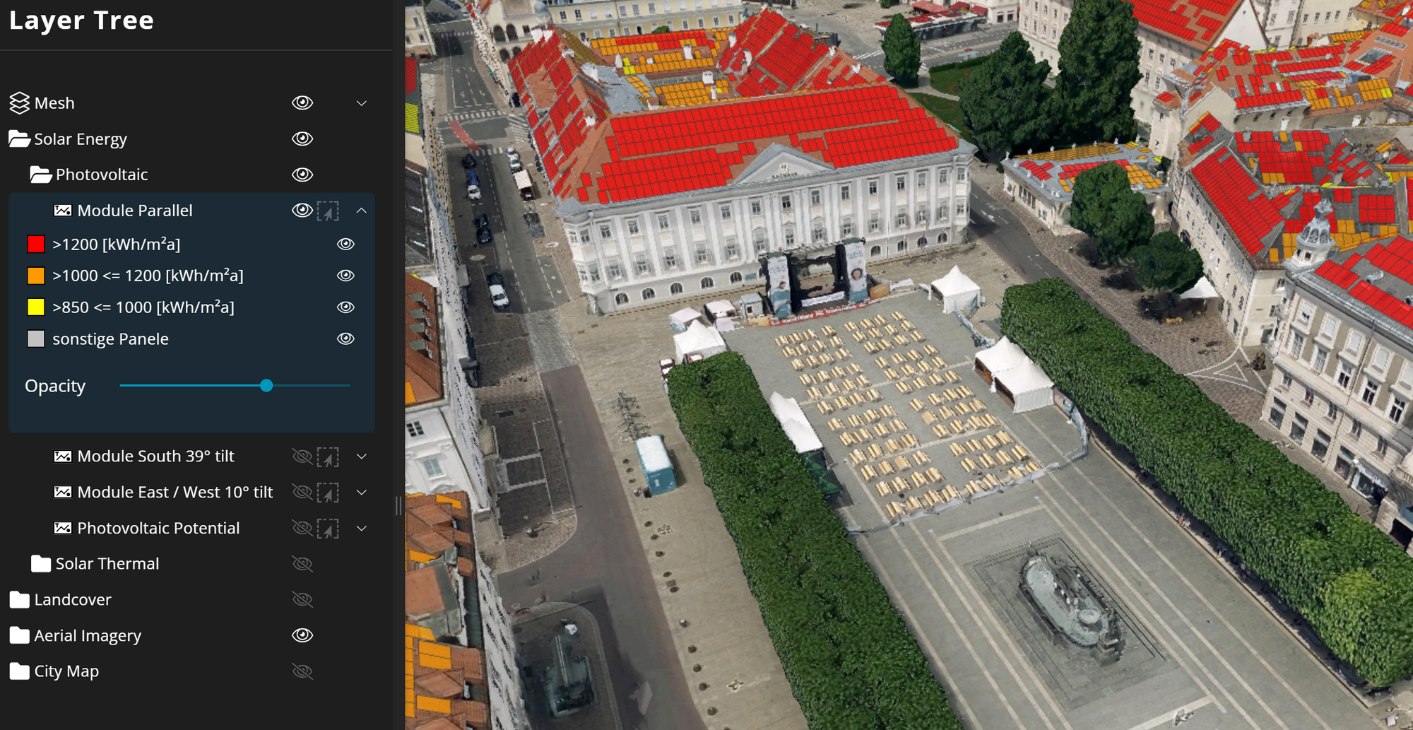
1) Solar energy potentials: Photovoltaic and solar thermal potentials were calculated for all roofs. Thereby, panel distinctions were made based on orientation and tilt.
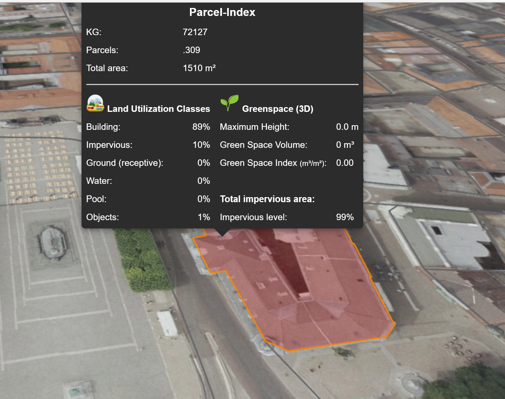
2) Parcels of the city of Klagenfurt with detailed attributes gained from spatial analyses are embodied in the App as well.
3) Finally, aerial imagery was included, consisting of an Orthophoto as well as a coarser Basemap.