Vector Sets
Vector sets allow you to bundle your vector layers into one layer. They are most commonly used to create base layers.
What are vector sets and why to use them?
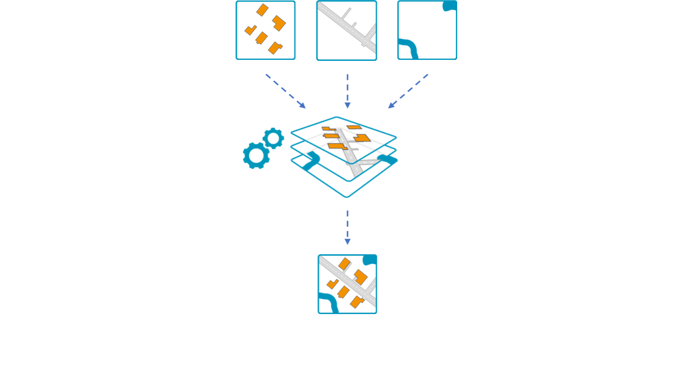
Vector sets can be used to combine multiple layers to one. It publishes all vector data configured in the same tiles. This method is called quad tree layer caching.
Considering you have layers with different geometric information (e.g. buildings, streets and borders, etc.), a vector set offers the opportunity to display all the information in one layer. However, this happens at a cost of layer simplification. This means verteces are significantly reduced.
Advantages
There are still several benefits to use vector sets in M.App Enterprise. Quad tree layer caching alone provides advantages for the user:
- Fast publishing
- Small cache size
- Low number of tiles
Moreover, the creation of vector sets come with full vector support and the map appearance is based on OGC Styled Layer Description and Symbology Encoding. Furthermore, all map projections are supported, while also handling different coordinate reference systems (CRS) and projections. At last, vector sets are consumable by all client types.
Prelimineries
In order to create a vector set, you need to have all geometry layers added as cached layers. Otherwise they won't even show up in the list of layers within the vector set configuration.
For more information on cached vector data, have a look at the article below.
 Stefan Schüttenkopf
Creating a vector set
Content → Vector Sets → New
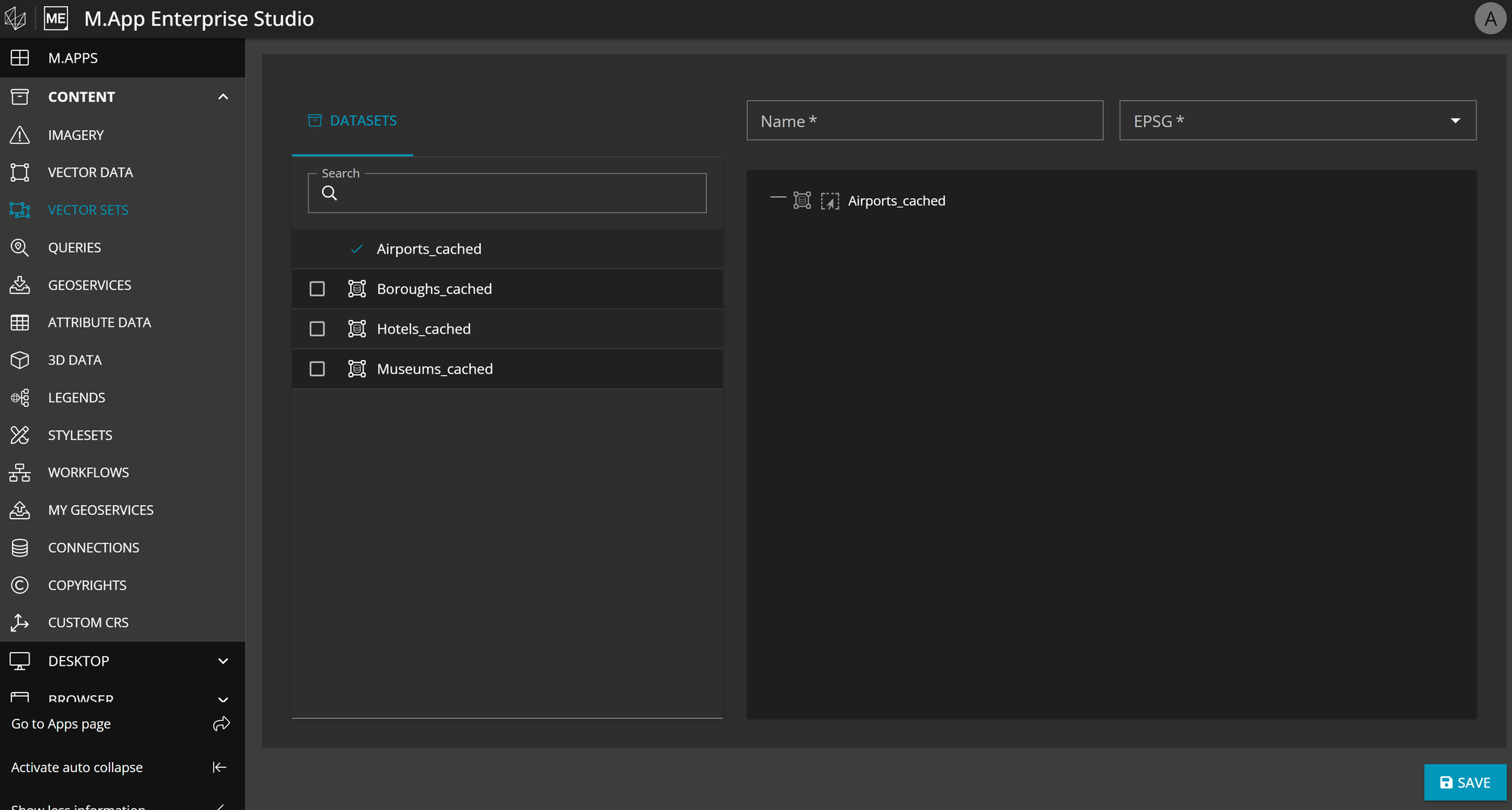
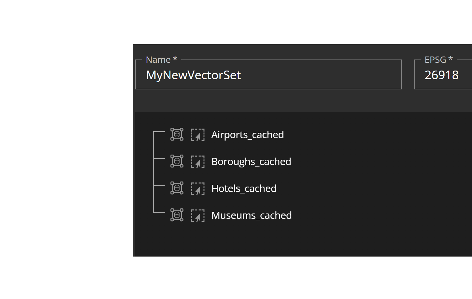
To create a vector set, select Vector Sets in the content menu and click on New. You will get a list with all datasets that you can combine in your vector set. Only cached data are available to choose from, which can be dragged and dropped as desired. Choose a Name and an EPSG code in which your data should be projected and Save your vector set.
Examples
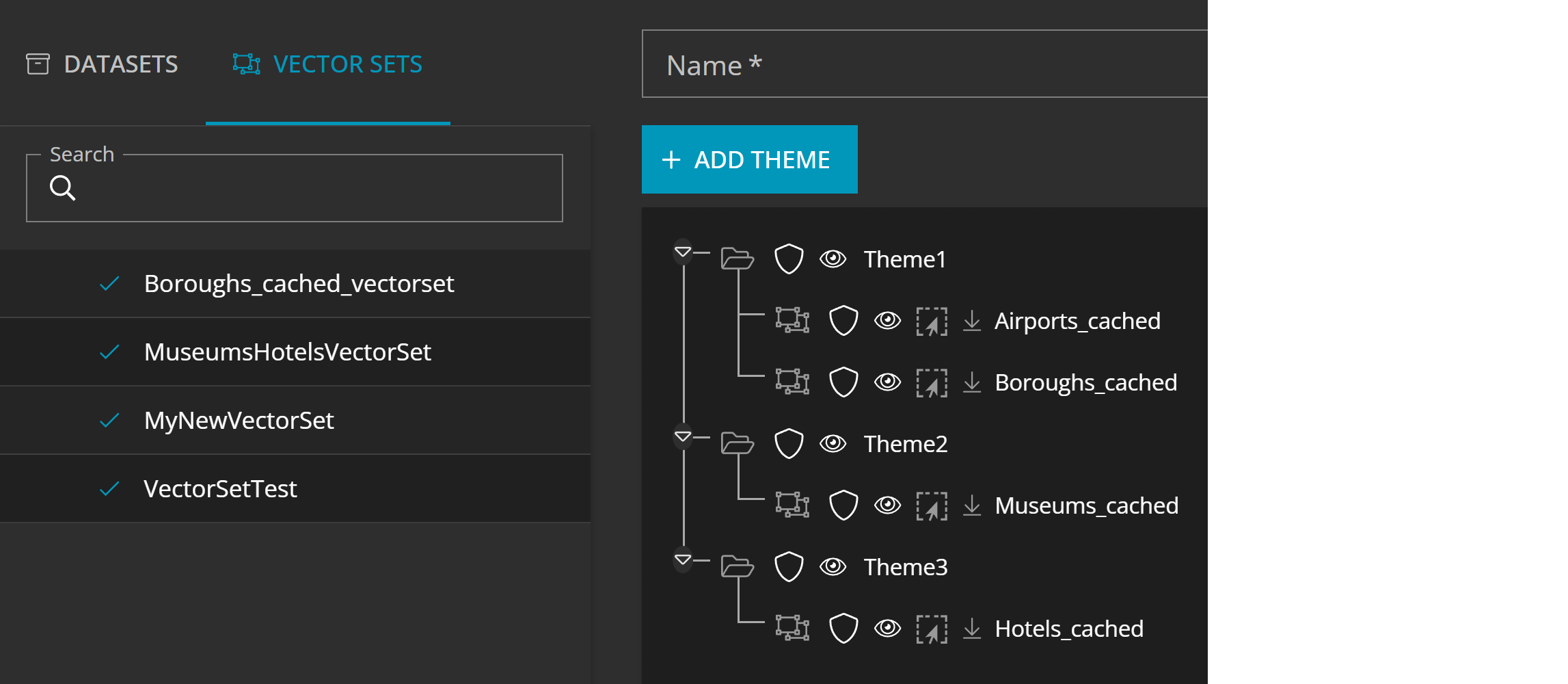
In this example you can see the steps of creation again. First, you create the vector set by adding available layers, before you can arrange the vector set in a legend. It is possible to put the individual layers of the vector set in different themes, or you can even delete a layer of the list, whatever fits your needs.
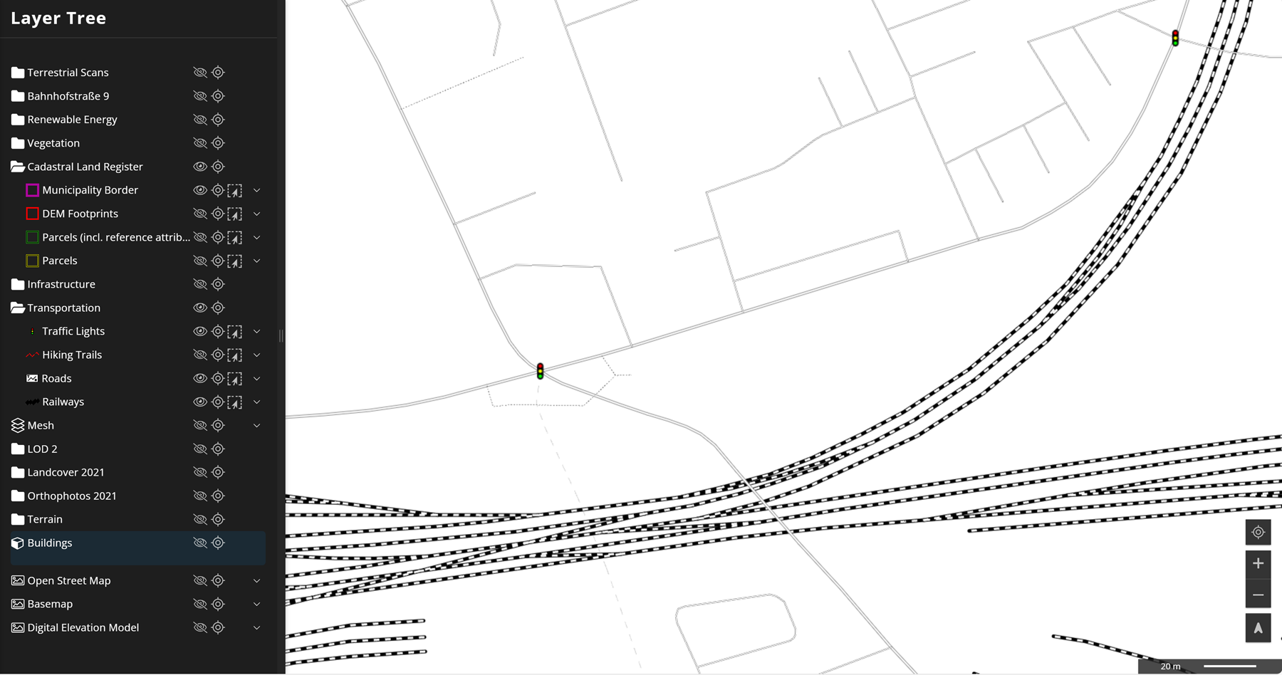
This shows an example of layers from a vector set, including streets, railways and traffic lights. They are perfectly suitable as background layers for general orientation.